Boston is famous for a bunch of things - the first settlers landed near here seeking freedom from religious persecution. Which they promptly used to persecute other religions instead. They've got a baseball team whose record in the last 100 years makes Richmond look good, they have one of the few decent major breweries in the US, US presidents go for holidays at an island off the coast, they're unjustifiably proud of their coffee (pronounced quaff-ee) and of course they are famous for their clam chowder. Now if you've ever watched the Simpsons you'll know why I spent a lot of the weekend shouting 'Chow-DAH! Chow-DAH!' at each place we ate. Gator Girl was a little embarrassed by my behaviour.
We arrived late Wednesday night and stayed at a nice little residence in the seaside suburb of Winthrop, just near the airport. We arrived pretty late and left early so didn't get to look around much. We did have time to have breakfast at a real locals place - two huge serves of pancakes plus coffee all for about $7.
Now we did a bit of driving while we were here, so I'm going to break with tradition and stick a map in here so that you can play along at home. It's easier to see if you click on it and open it as a separate tab. Boston is right up on the north-east coast of the US. On the Thursday morning
 after breakfast we drove south down the coast, eventually to Provincetown which is on the very tip of Cape Cod. Cape Cod is the sticking-out bit of the land which goes first east and then north from the mainland. To the south are the islands of Martha's Vineyard and Nantucket. The first stop we came to was Plymouth which is about half-way down the coast to Cape Cod. This is famous as it is where the pilgrims made their first permanent settlement. They arrived in 1620 and supposedly stepped onto 'Plymouth
  Rock' when they first made landfall. This set us up for the lamest tourist attraction we've seen in a while. Not only is the rock quite dull (and I'm an expert), it's also not the actual rock they stepped on; it's been moved several times snice 1620; the story that they stepped onto a rock in Plymouth is supposedly a myth and besides they first made landfall in Provincetown. So with a dismissive 'bah' at the gaggles of school students gaping at this blatant falsification of US history, we continued south.
We took the road less travelled as we weren't really in a hurry, so took the local roads east out onto Cape Cod. On the way we came across a bunch of rather funky little shops selling everything from antiques, artwork & kitchen accessories. Naturally we stopped at the shop selling kitchen accessories. In there I found lots of cool ingredients that I'd been missing in Louisiana, specifically Ketjap Manis & Shrimp paste. Thai & Balinese curries here we come! I refrained from buying the pizza stone as I didn't want to try and get it into my carry-one luggage. I got so excited I had to show my appreciation to the man out the front.

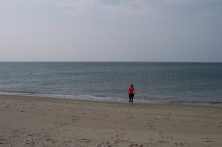
Further along the road we stopped off at some of the southern beaches which were very nice and also pet friendly. Shame we'd left the puppy in the kennel for this trip. Somewhere in the distance in this photo is the island on Nantucket, which inspired me to compose a limerick.
 In the distance the isle of Nantucket
I might see it if I stood on a bucket
It's a very long way
Getting there takes a day
Should I bother? Nah....
We then headed north up to Provincetown, placed right on the tip of Cape Cod. This place was sensational, I can't rate it highly enough. The town itself is - how shall I say it - tolerant towards alternative lifestyles. We stayed at a beautiful B&B called Carpe Diem which is run by three wonderful German guys. The room was great, they had wine & cheese at 5pm every night, spa, breakfast made on demand including a mix of German & US staples, port in the main room if you feel the need for an evening snifter, and everything you could want for a brilliant weekend away. If you ever get the chance to visit Provincetown, stay with these guys, you won't regret it.
 Gator Girl posing in front of the Carpe Diem. Our room was on the top floor, at the front corner.
Ok, blatant advertising over, we spent the rest of the afternoon exploring Provincetown. It's a old fishing village that has become a pretty vibrant artist community. Every second shop is selling artwork of one type or another. It's also surrounded by coastline which is mostly undeveloped, hence there's a large network of dunes with only walking and cycling paths to help you get around. In a way it reminds me of Rotto as there's lots of beaches you can't drive to, so getting a bit of sand to yourself is easy to do. We hired some bikes and rode to the other side of the cape and thought about having a swim.
 Gator Girl showing off the main street on Provincetown.
 The beach of the far side of the cape. And this is getting towards summer!
 I said we thought about having a swim - we got in up to our ankles even after a long bike ride. The weather might be warm but that water was still seriously chilly. Nice beach to just sit and relax on though.
 I was particularly amused by this sign - why is it necessary to ban pet flying? There's got to be a good story there.
 All good towns have a old tower in the centre of them.
 So naturally we climbed it.
We ended up having dinner at a local restaurant, drank a bottle of champagne and a bottle of wine and rolled home to the B&B, a little too overindulged to properly enjoy the snifters of port on offer.
Next morning we regretfully had to get up and continue our explorations. We would have quite happily stayed in Provincetown a lot longer, but still had long lists of things to explore in Boston.
We didn't head directly back to Boston, instead we took a detour to the south coast and headed to Newport for lunch, stopping at a few little towns along the way. Newport is actually over the state line into Rhode Island (for those of you ignorant about US geography, Boston is in Massachusetts). And if you know your Gator Girl history you'll know she spend several months here doing summer camp way back before she knew the joys of the swamp.
We had some clam chow-DAH for lunch which was pretty good, but the high point of any chowder dish is the ordering, not the eating. After that we went and did a drive-by of Gator Girl's camp, then heading north back towards Boston, stopping briefly in Providence on the way through.
 A nice beachside building in Narragansett (nowhere important).
Looking back now at the the pictures of the two days we spent in Boston, I now realise that we have 6 of Faneuil Hall, 1 of the outside of Cheers, and nothing else. This is a pretty lame effort as Boston is a fantastic city and really worth visiting. But you're not going to get any kind of visual encouragement from this blog.
Let's see what I can describe. Boston has been doing major roadworks for the past 15 years, on a project generally called the 'big dig.' They have put pretty much every major road in the CBD underground, so that everything at street level is pedestrian friendly. It's really easy to walk anywhere in the center of town, and in fact it's a lot easier to walk than to drive. They've also got a great subway system with stops every few hundred metres in the centre of town, so that you're never far away from a train station.
They have a vibrant italian district in town where we went for dinner on the Saturday night. They have a huge green space in the centre of town called Boston Common which was great to walk around. It's got bustling marketplaces like Faneuil Hall and lots of cool old buildings.
 One of the six photos of Faneuil Hall and a statue of Sam Adams - don't know what he did in the past but he's got a beer named after him now.
On the Sunday we went for a tour around town and saw Cambridge & MIT, Fenway Park (the home of their loser baseball team), the common, the harbour where the Boston tea party took place and lots of other neat stuff that if I'd taken a photo of I might have remembered. That night we had tickets to see the Blue Man Group (performance art, ok, outstanding in parts, average in parts) & went to dinner at a tasty indian restaurant. We also explored the funky shopping strip of Newbury street, where Gator Girl bought new clothes and hiking boots and I finally got my first decent haircut since coming to the US.
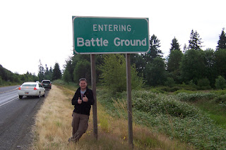
 This ran a close second to Plymouth Rock in the 'lamest tourist attraction' contest. I was quite cold, by the way.
We didn't have much time to look around on the monday as we had to start the long flights back to Louisiana. Apologies again for the lack of photos of Boston, but trust me, it's a fun city and worth exploring.


